
| Darin McQuoid | Blog | Reviews | Tutorials | River Directory |
Clear
Creek
(Sacramento Tributary)
IV
(Sacramento Tributary)
IV
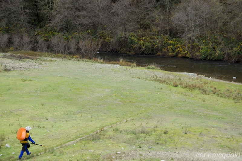
Clear Creek is minutes outside the city of Redding in far Northern California. The run is good but not classic, and probably wouldn't see nearly as many descents; but it has water when nothing else does. Various forks of the Trinity River start high in the Trinity Alps Wilderness and quickly flow into Trinity Lake. From there water is moved to Lewiston Lake, a glorified diversion dam that moves some of the water out of the Trinity River watershed and into the Sacramento watershed. In this process the water gets stored in Whiskeytown Lake. As a recreational lake, Whiskeytown is kept as full as possible until the late fall. Then the lake is drawn down to make room for winter and spring water, resulting in fall and winter flows on Clear Creek below Whiskeytown Lake. It's a low volume run that starts off mellow and surprisingly scenic for the low elevation and proximity to town.
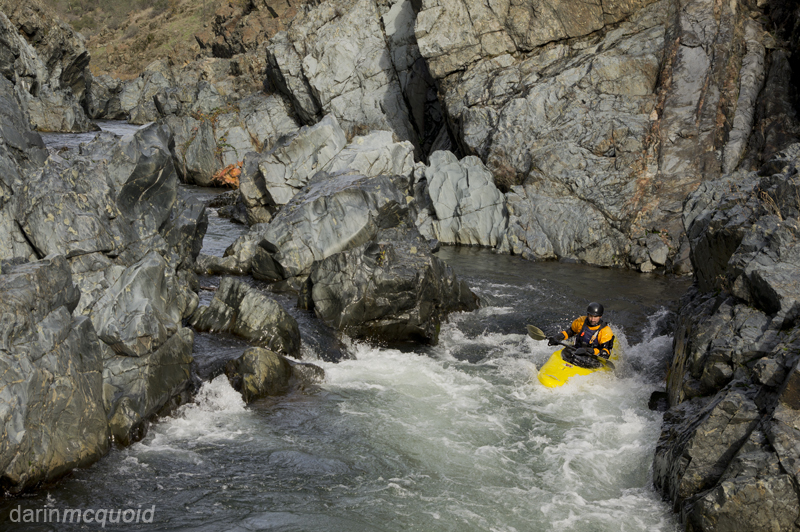
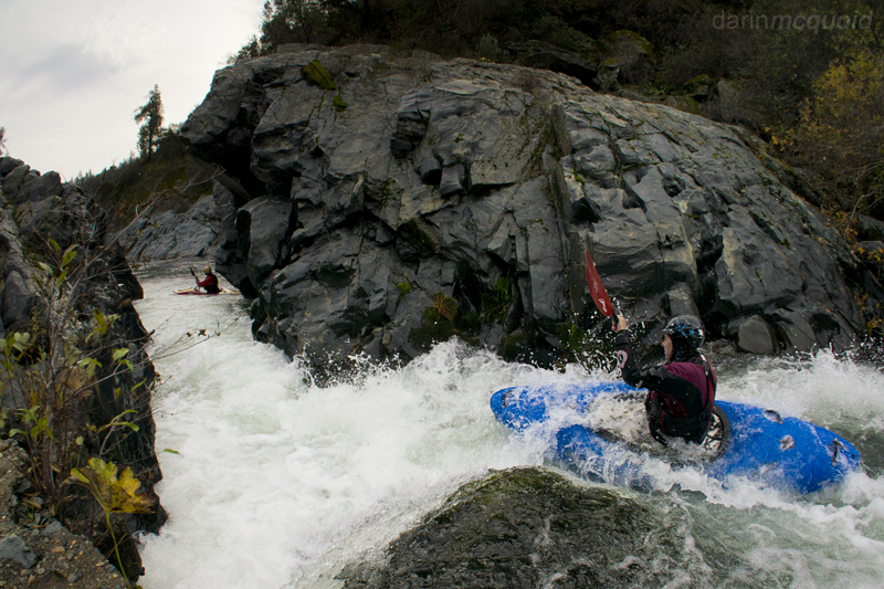
Joe Reiss in "Pinch Me"
Shawn McNeely on the same.
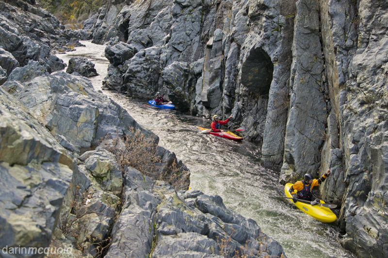
The crew waits in a nice mini-gorge below pinch me.
Most of the run is scenic class II.
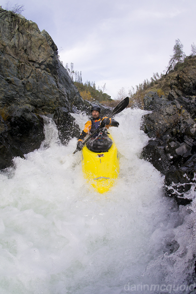
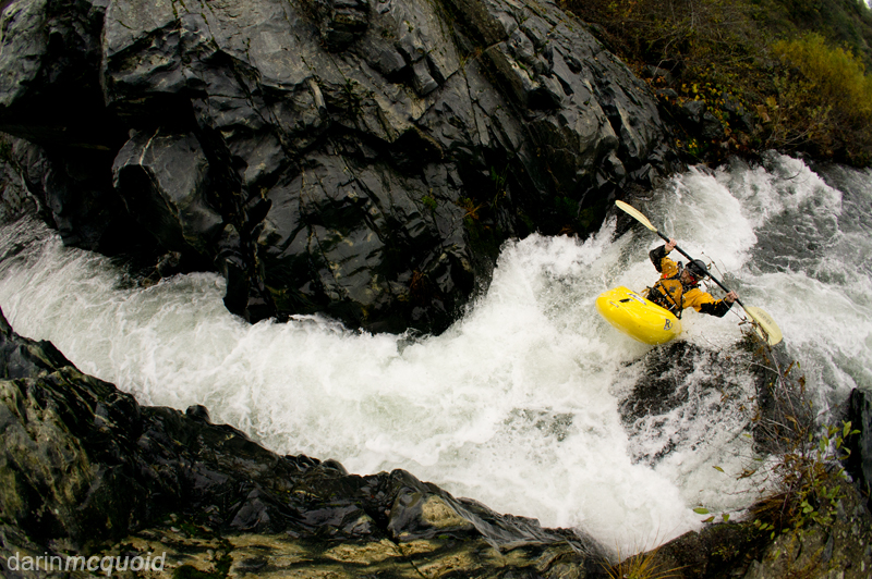
Shawn McNeely runs Ski Jump, the hardest rapid on Clear Creek.
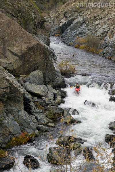
Ski Jump is the hardest rapid of the run and due to hazard may warrant a IV+ rating, but it's easily portaged on the left.
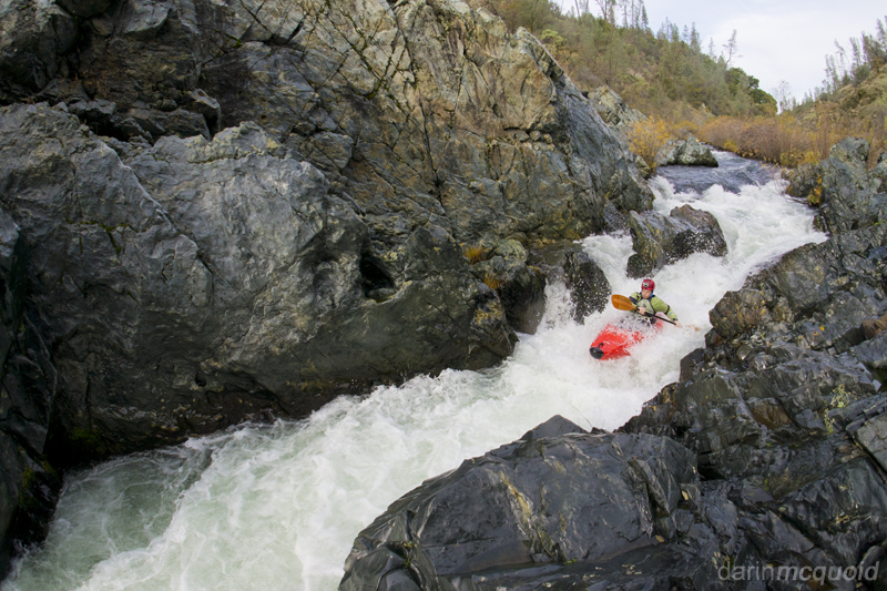
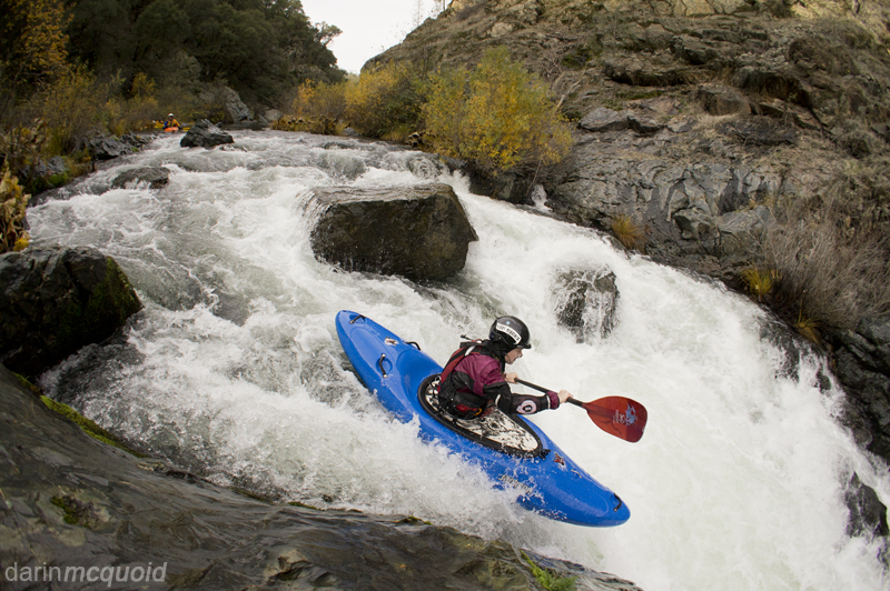
Shannamar Dewey boofs out of Ski Jump.
Not too far below Ski Jump, Shannamar runs a nice boof.
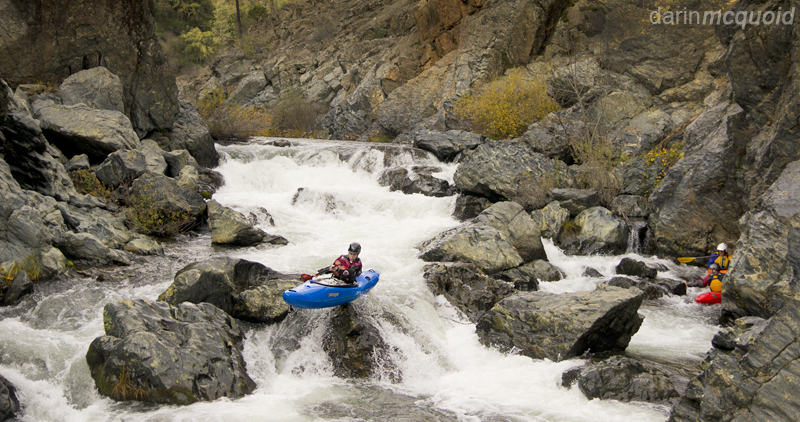
Shannamar enters "Pinch me again".
Jerimy McNeely boofing into Pinch me again.
Shawn McNeely on the same.
The crew waits in a nice mini-gorge below pinch me.
Most of the run is scenic class II.
Shawn McNeely runs Ski Jump, the hardest rapid on Clear Creek.
Ski Jump is the hardest rapid of the run and due to hazard may warrant a IV+ rating, but it's easily portaged on the left.
Shannamar Dewey boofs out of Ski Jump.
Not too far below Ski Jump, Shannamar runs a nice boof.
Shannamar enters "Pinch me again".
Jerimy McNeely boofing into Pinch me again.
Below "Pinch me again"
Clear Creek is mellow until the first possible take-out, Placer
Road/County Road A16. Taking out here is a bit pointless though, there
isn't much parking, it's a steep climb to the road and some of the best
III-IV rapids are between here and Clear Creek Road. Locals will put on
here for a quick afternoon lap on the fun section below. Unfortunately
on this trip it was late in the day and we didn't have enough time to
capture more images.
Gauge: Clear
Creek below
Whiskeytown Lake.
Ideal flow: 200-600cfs.
Run Length: 7.5 miles
Put-in: Need Camp Bridge over Clear Creek. 40°34'47.02"N / 122°32'17.58"W
Take out: Bridge on Clear Creek Road. 40°29'39.50"N / 122°29'53.95"W
There are many ways to shuttle Clear Creek. Here is one that can be done in a regular car. From take out continue West on Clear Creek Road. Make a right onto Cloverdale Rd. In under two miles Cloverdale will T into County Road A16, which you will turn right onto. After around five miles make a left onto Swasey Drive. Four miles later Swasey Drive will T into Highway 299. Turn left onto 299 and follow for under three miles to a left turn onto JF Kennedy Memorial Drive. After 1.5 miles the road makes a Y, stay left on Paige Bar Road and follow for two miles to the bridge over Clear Creek.
HTML
Comment Box is loading comments...