
| Darin McQuoid | Blog | Reviews | Tutorials | River Directory |
Goose
Creek
IV-V
IV-V
Goose Creek is one of the
more well known
tributaries in the Smith drainage, thanks to excellent write-ups at both Oregon
Kayaking and California
Creeks.
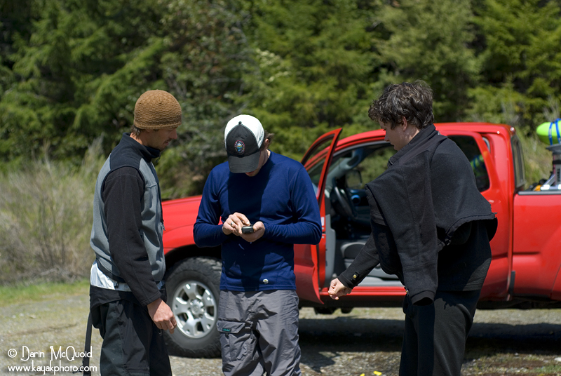
The first time I went for Goose Creek we couldn't find the correct
shuttle road, but returning armed with a GPS and Google Earth
coordinates we felt sure of getting the goose this time...
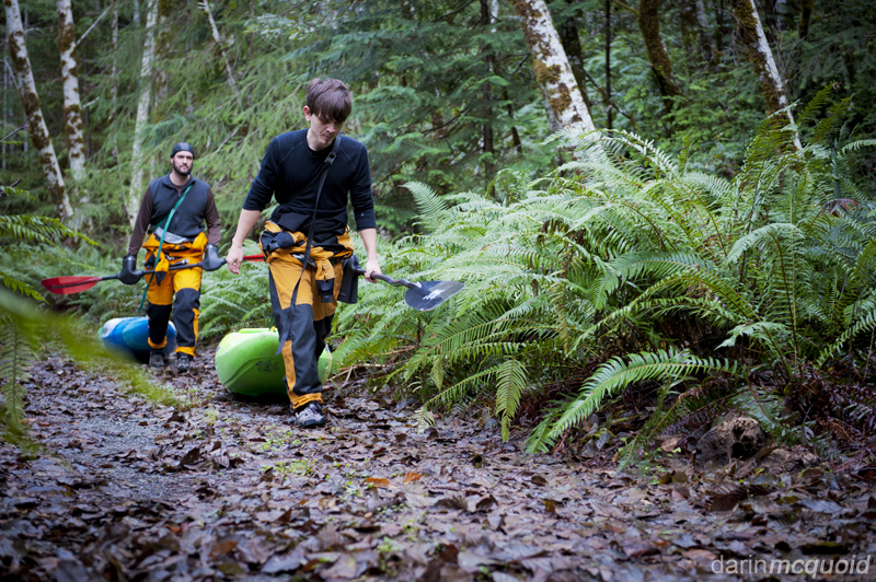
The closed road now requires paddlers to hike more miles than there are good rapids, so at the time we opted for some classic gorge runs. We returned the first day in 2012 ready to hike in and see what the creek had to offer. There are various opinions on the length of the hike, but according to Google Maps it's almost 3.5 miles and certainly feels like it. The road is mostly level, and you can drag your boat but expect it to take more abuse then you'd think.
This
must be it!
Unfortunately in December 2007 there was a major slide on the Forest Service road that gives access to Goose Creek, and the road is now permanently closed.
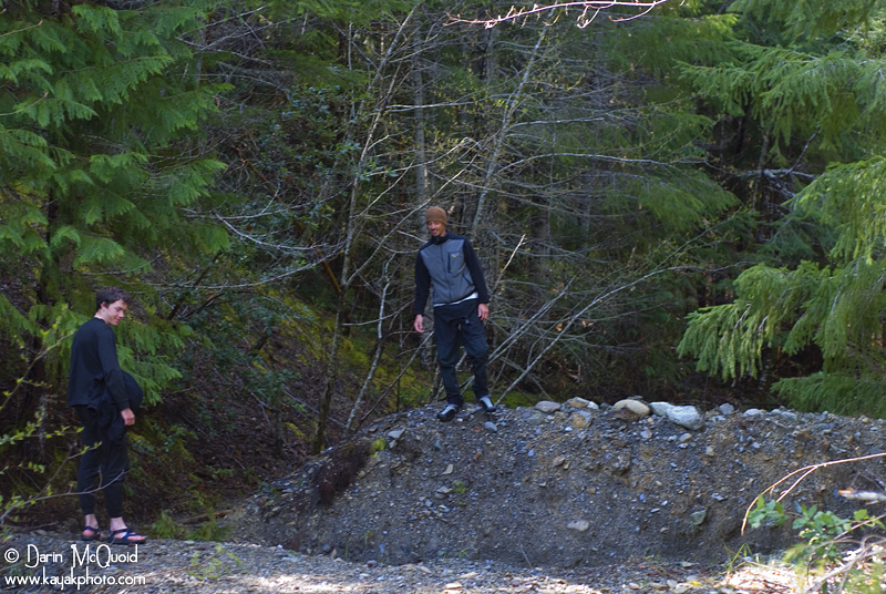
Unfortunately in December 2007 there was a major slide on the Forest Service road that gives access to Goose Creek, and the road is now permanently closed.
The closed road now requires paddlers to hike more miles than there are good rapids, so at the time we opted for some classic gorge runs. We returned the first day in 2012 ready to hike in and see what the creek had to offer. There are various opinions on the length of the hike, but according to Google Maps it's almost 3.5 miles and certainly feels like it. The road is mostly level, and you can drag your boat but expect it to take more abuse then you'd think.
Daniel
Brasuell and David Maurier
enjoying the lush greenery of California's North Coast.
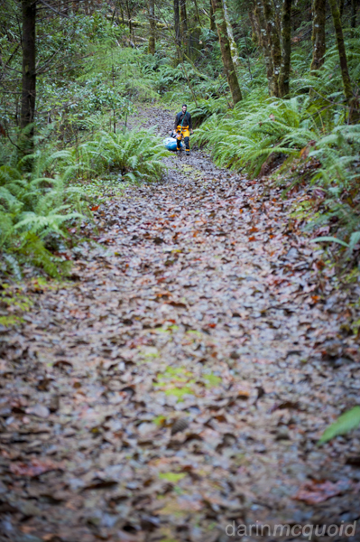
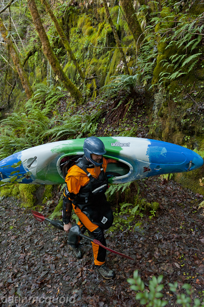
Still nice and lush. Not enjoying it quite as much at this point on a light uphill.
After three miles of hiking we hit a spur that dropped us to the river. Vegetation was thick, and we decided to go straight through it to find the water we could hear.
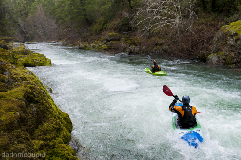
Goose Creek is no small creek, in fact it's more of a riverbed. Daniel and David head downstream.
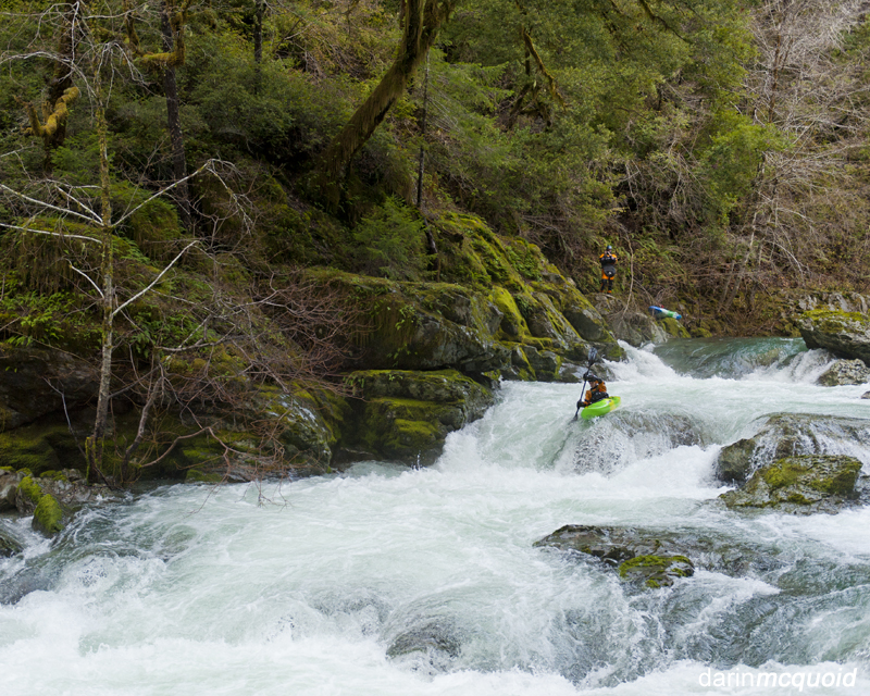
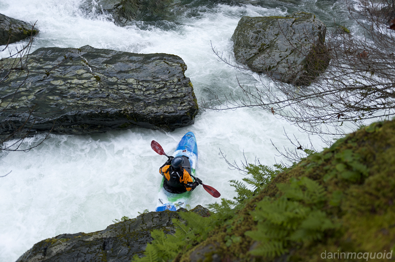
David Maurier runs the first rapid of the run; Gander.
A short mellow sections followed before we scrambled out to scout Honker. Amazing how the river can change over the years, we had no problem scouting on the right.
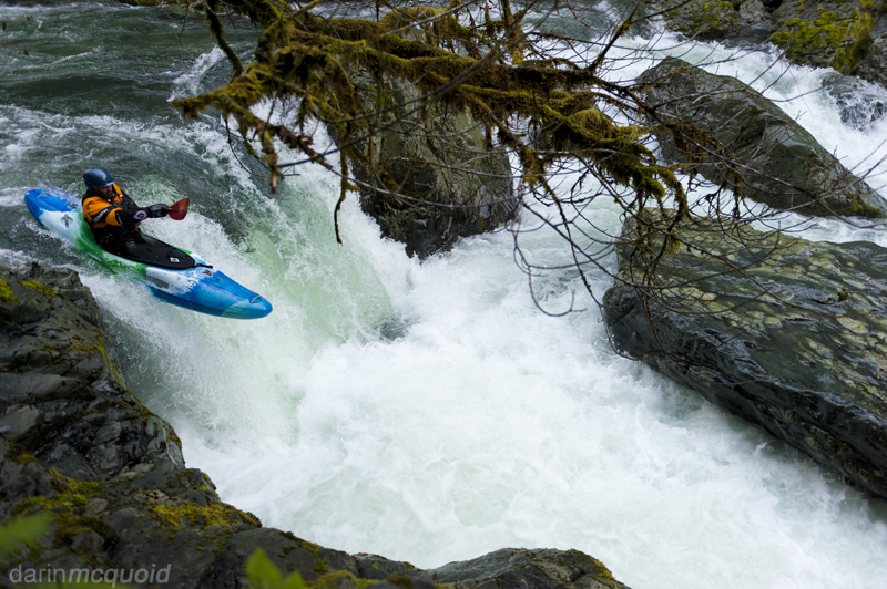
Daniel Brasuell boofs right to avoid the undercut rock.
Lots of water moving into the undercut boulder.
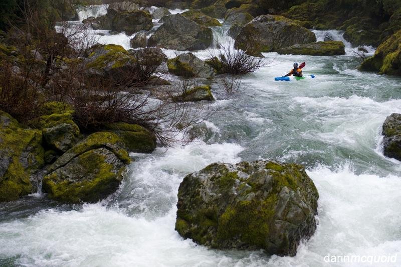
Looking back upstream at Honker as Daniel approaches the run-out boulder garden.
We assumed the run-out of Honker was Ugly Duckling and were thought it was over as we paddled a scenic mile with no significant rapids.
Still nice and lush. Not enjoying it quite as much at this point on a light uphill.
After three miles of hiking we hit a spur that dropped us to the river. Vegetation was thick, and we decided to go straight through it to find the water we could hear.
Goose Creek is no small creek, in fact it's more of a riverbed. Daniel and David head downstream.
David Maurier runs the first rapid of the run; Gander.
A short mellow sections followed before we scrambled out to scout Honker. Amazing how the river can change over the years, we had no problem scouting on the right.
Daniel Brasuell boofs right to avoid the undercut rock.
Lots of water moving into the undercut boulder.
Looking back upstream at Honker as Daniel approaches the run-out boulder garden.
We assumed the run-out of Honker was Ugly Duckling and were thought it was over as we paddled a scenic mile with no significant rapids.
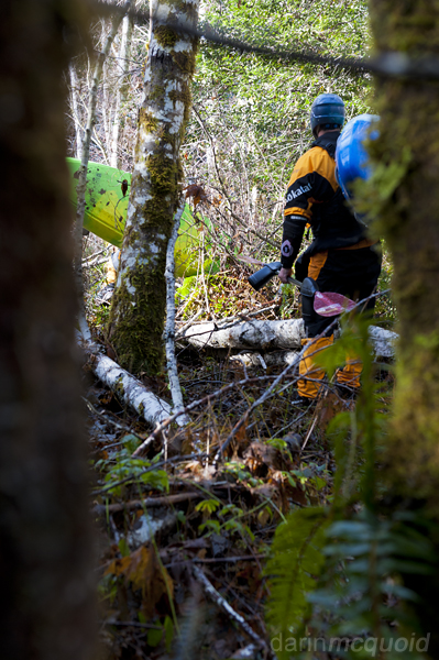
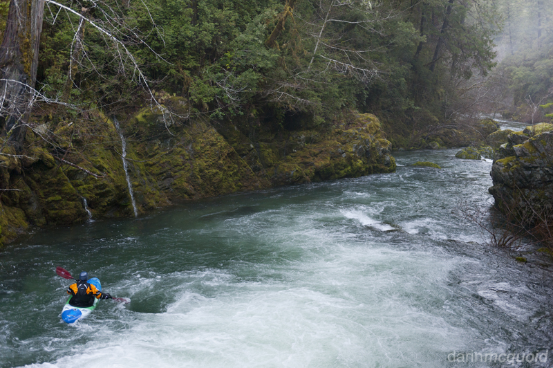
Suddently we're at the top of a
larger
rapid and past any eddies. A large tree is on the right side of the
rapid, so we enter left and get around the tree, only to make a quick
ferry back to the right. Whoah that was a surprise! The log makes Ugly
Duckling tougher than it normally would be, blocking the standard right
line.
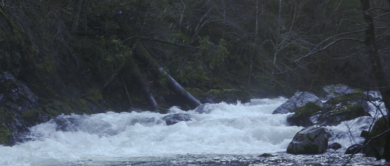
The
log extends further into the rapid
than it would appear to in the image.
Below that we slipped back into scenic bliss and made quick
time
down the South Fork Smith confluence. Daniel
heads up to the bridge and warm
cloths.
Even with the longer hike
in, Goose Creek is certainly worth doing. Not something I'd run laps
on, but every few years I'll wander in there to enjoy three great
rapids and some fantastic scenery that is very unique for California.
Take Out: From Highway 199 take the South Fork Road for 12.5 miles and park at the bridge.
Put In: Continue up the South Fork Road for just under one mile and make a right onto a bridge over the river. After 2.6 miles on this road is a large clearing on the right. Go into the clearing and park. The road on the left, with the embankment, leads to the river.
There is no gauge for this run, it's best to go after some heavy rain.