
| Darin McQuoid | Blog | Reviews | Tutorials | River Directory |
Yét Atwam Creek IV-IV+
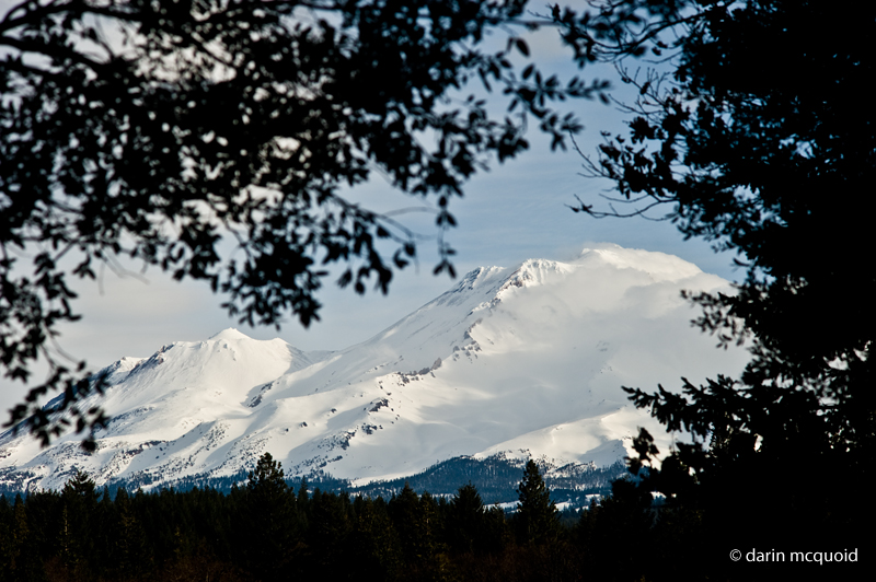
Yét Atwam Creek may just be California's finest class IV run. What's amazing is that this run has never appeared in a guidebook and lies in obscurity. This beautiful run starts off as a small mountain stream flowing off the southern flanks of Mount Shasta before exiting Yét Atwam Valley for an exciting eleven mile run into the McCloud River, one of the other best class IV runs in the state. That's right, not just one but two epic class IV runs for the price of one, just over twenty miles of beautiful scenery and great rapids.
The creek hardly appears possible at put-in, with a paltry flow of 200-300cfs. Thankfully it's channelized well and action picks up right below the parking area.
The creek is non-stop class II or III for several miles, although there are eddies pools are lacking at first. Several miles into the run and a few significant rapids under the belt, the first falls can sneak up on you.
Shortly after the falls, tributaries start to contribute significant amounts of water and the creek starts to look more like a river. Good action continues on until suddenly private bridges appear overhead and you are in the domain of private fishing clubs. These bridges mark the start of a tougher section of Yét Atwam Creek where several class IV rapids come back to back, and one verges on V-.
Once the big rapid is behind you, there are many miles of fast moving water and one more IV before the confluence with the McCloud. Yét Atwam Creek swells to two-thirds of the final flow and really feels like a river down here. Once at the confluence with the McCloud, it's another ten miles of the best section of this great river at ideal flows. If you're moving fast the McCloud will only take an hour or two to complete.
Twenty odd miles is a long day on the river. It's best to start early and go with someone who knows the run or is confident boat scouting. If you don't have either of these, consider enjoying Yét Atwam Creek as a fantastic overnight. Just be sure to camp before the falls on the right, the only sort of "beach" you'll see on the run. It's the last spot before it all turns to private land, whose owners frown on any besides themselves enjoying these beautiful water ways.
I've done the run with flows from 1,200 to 3,600cfs on the McCloud at Shasta Lake gauge. I think around 2,000cfs is ideal.
Take-out: From Highway 5 take Gillman Road east (South of Dunsmuir some 20 miles). Follow for 17 miles to the bridge over the McCloud arm of Lake Shasta.
Put-in: Continue North on Highway 5, Take Highway 89 east towards McCloud. Once in the town of McCloud, take Yét Atwam Valley Road. After a few miles, at the end of a meadow there is a sign for Squaw Valley Creek to the right, follow the dirt road for the 2 miles to the bridge over the creek and the sign for the Cabin Creek Trailhead. If you end up at Lake McCloud, you have gone too far, turn around and look for the dirt road.
[2019
Update: Wood has often been a minor issue on Yét Atwam Creek
into
the McCloud, but this last summer the Hirz Fire burned to the river's
edge. Fire fighters dropped hundreds of trees on the right bank of the
Yét Atwam Creek, and many of them are across the riverbed. We
had
very low flow and only two log portages, yet ducked ~10 logs that would
pose significant hazard at higher flows.
No logs are on the McCloud yet, but a high water event could change that.
We had 1500 on the gauge when we put in and 1300 when we took off. Either the gauge has been recalibrated, or needs to be recalibrated as both Yét Atwam Creek and the McCloud River were considerably lower than on any previous trip I'd done, including one where the gauge read 1200 when we put on. I'd guestimate it was 1/3 lower than said previous trip, if not half the flow.]
Yét Atwam Creek may just be California's finest class IV run. What's amazing is that this run has never appeared in a guidebook and lies in obscurity. This beautiful run starts off as a small mountain stream flowing off the southern flanks of Mount Shasta before exiting Yét Atwam Valley for an exciting eleven mile run into the McCloud River, one of the other best class IV runs in the state. That's right, not just one but two epic class IV runs for the price of one, just over twenty miles of beautiful scenery and great rapids.
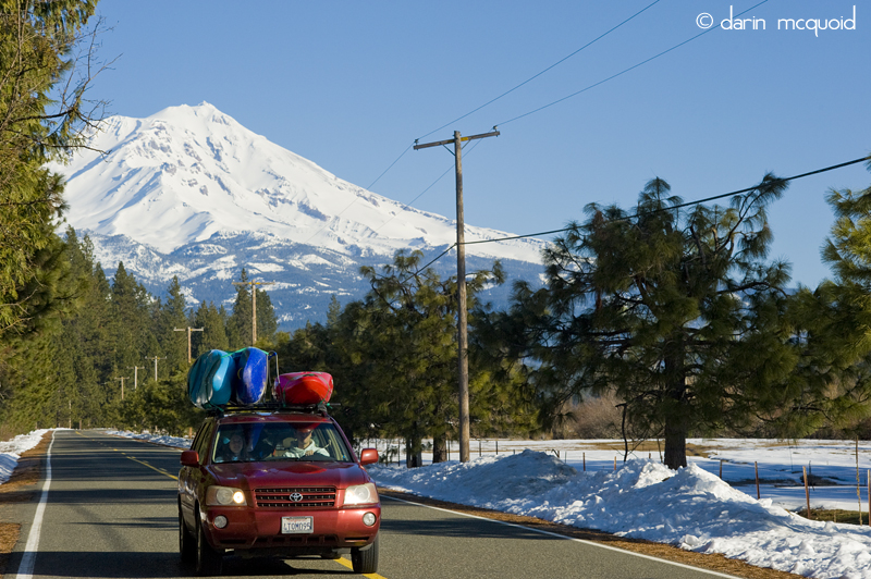
Views
aren't bad during the shuttle either.
Beware that early in the winter the put-in at Cabin Creek can be snowed in.
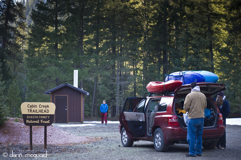
Beware that early in the winter the put-in at Cabin Creek can be snowed in.
The creek hardly appears possible at put-in, with a paltry flow of 200-300cfs. Thankfully it's channelized well and action picks up right below the parking area.
Daniel
Brasuell in an early one.
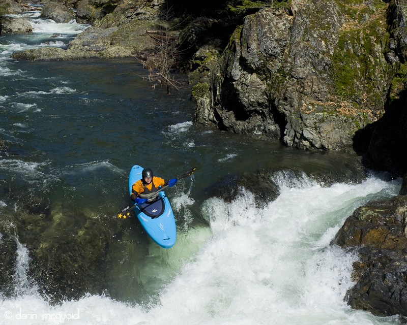
The creek is non-stop class II or III for several miles, although there are eddies pools are lacking at first. Several miles into the run and a few significant rapids under the belt, the first falls can sneak up on you.
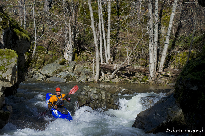
Diane
Gaydos runs the first of the falls on Yét Atwam Creek

Only a few corners below the first falls is the second "falls" which is really more of a ledge, run here by Daniel Brasuell.
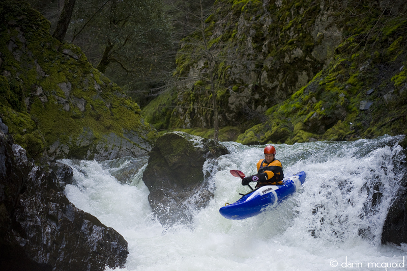
Only a few corners below the first falls is the second "falls" which is really more of a ledge, run here by Daniel Brasuell.
Many miles of III with the occasional IV continue in epic wilderness
scenery.

Shortly after the falls, tributaries start to contribute significant amounts of water and the creek starts to look more like a river. Good action continues on until suddenly private bridges appear overhead and you are in the domain of private fishing clubs. These bridges mark the start of a tougher section of Yét Atwam Creek where several class IV rapids come back to back, and one verges on V-.
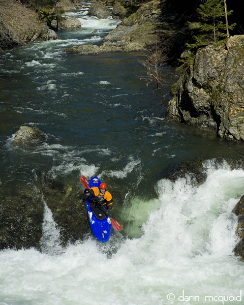
Daniel
Brasuel punches a large hole in the IV+ with a big IV just upstream.
Daniel exits the same via a nice boof on the right.
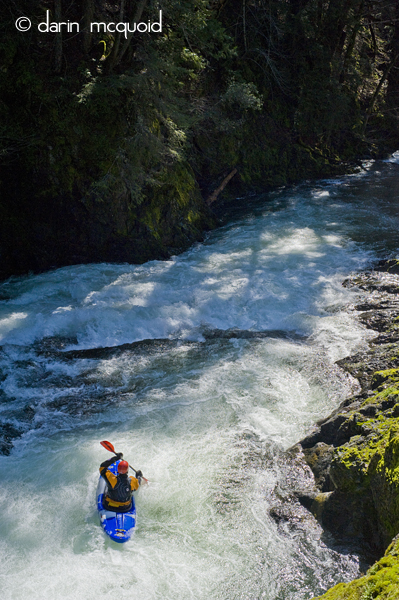
Daniel exits the same via a nice boof on the right.
Once the big rapid is behind you, there are many miles of fast moving water and one more IV before the confluence with the McCloud. Yét Atwam Creek swells to two-thirds of the final flow and really feels like a river down here. Once at the confluence with the McCloud, it's another ten miles of the best section of this great river at ideal flows. If you're moving fast the McCloud will only take an hour or two to complete.
Twenty odd miles is a long day on the river. It's best to start early and go with someone who knows the run or is confident boat scouting. If you don't have either of these, consider enjoying Yét Atwam Creek as a fantastic overnight. Just be sure to camp before the falls on the right, the only sort of "beach" you'll see on the run. It's the last spot before it all turns to private land, whose owners frown on any besides themselves enjoying these beautiful water ways.
I've done the run with flows from 1,200 to 3,600cfs on the McCloud at Shasta Lake gauge. I think around 2,000cfs is ideal.
Take-out: From Highway 5 take Gillman Road east (South of Dunsmuir some 20 miles). Follow for 17 miles to the bridge over the McCloud arm of Lake Shasta.
Put-in: Continue North on Highway 5, Take Highway 89 east towards McCloud. Once in the town of McCloud, take Yét Atwam Valley Road. After a few miles, at the end of a meadow there is a sign for Squaw Valley Creek to the right, follow the dirt road for the 2 miles to the bridge over the creek and the sign for the Cabin Creek Trailhead. If you end up at Lake McCloud, you have gone too far, turn around and look for the dirt road.